360Cam
A 360° Video Dataset for 3D Reconstruction, Neural Rendering, and Embodied AI
Figures updated
Overview
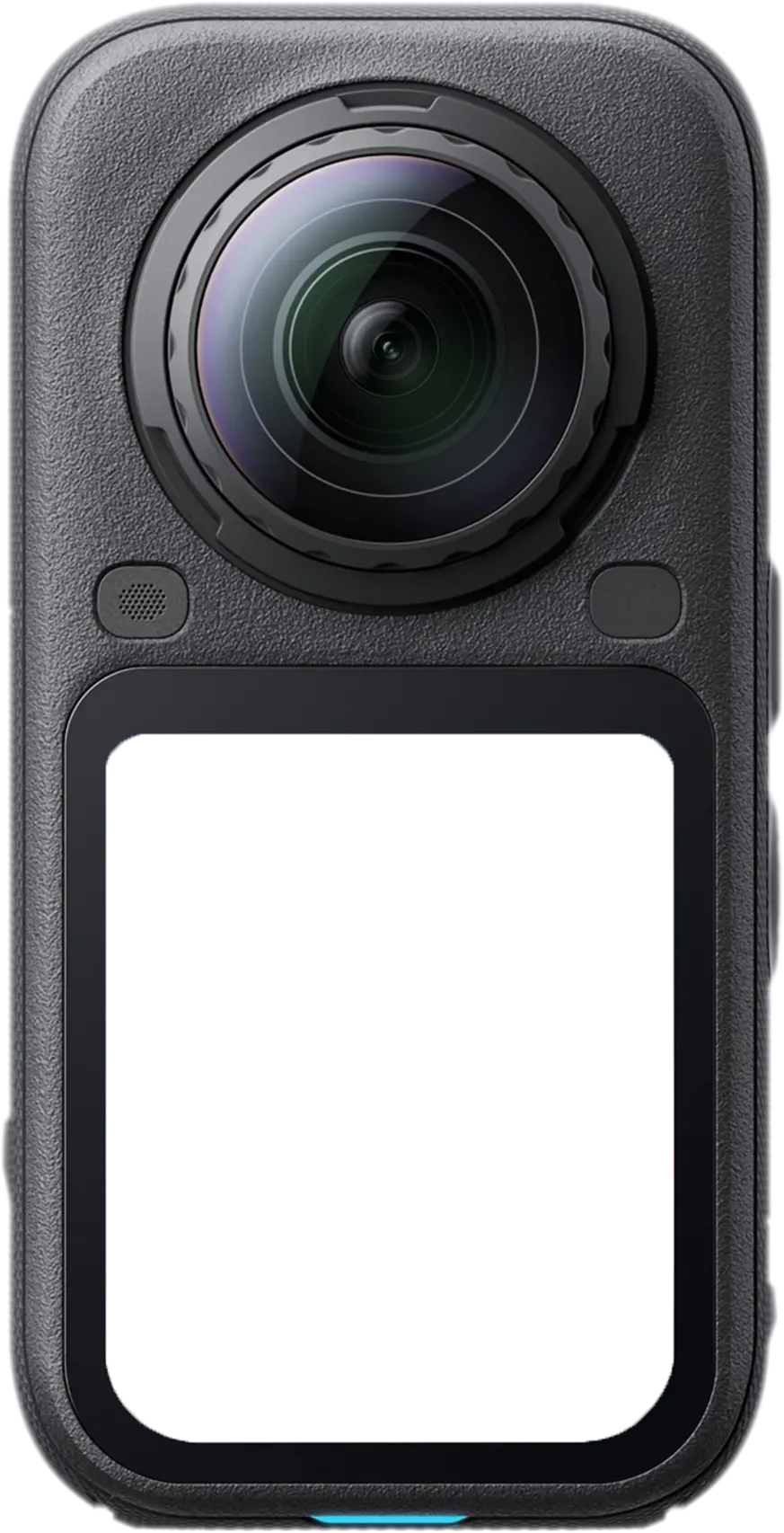
OverMaps-360Cam is a collection of real-world walking captures recorded with Insta360 X5 and X6 dual-fisheye 360° cameras at 8K. Its 2,712 scenes span 29 countries and 125 cities, totalling over 500 hours of capture and 2,200 km of walked paths. Each processed scene ships with the original .insv recordings, the camera's raw IMU stream and a GPS track, dual-fisheye frames, perspective views with COLMAP poses, 3D Gaussian Splatting models, textured meshes, walkable navmeshes, and rich semantic annotations — all processed with privacy-preserving pipelines.
Raw 8K .insv Video
The original Insta360 X5 and X6 .insv recordings, plus extracted dual-fisheye frames at 3840×3840 per lens.
IMU & GPS
The camera's raw gyroscope and accelerometer stream and a GPS track for every walk. The IMU recovers metric scale within 0.39% median error of a LiDAR reference (validation).
COLMAP & 3D Gaussian Splatting
~12K rectified 1600×1600 perspective views per scene with COLMAP poses and point clouds, plus pre-computed 5M-Gaussian 3DGS models (.ply and .splat).
Simulation-Ready Meshes
Textured GLB/USDZ meshes, a collision mesh in three LOD tiers (1/3/10 cm error), metric floor alignment, and walkable navmeshes certified with Isaac Sim and MuJoCo physics tests.
Semantic Annotations
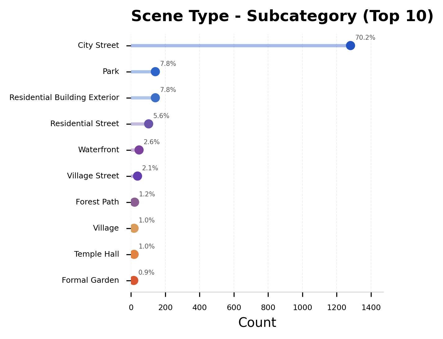
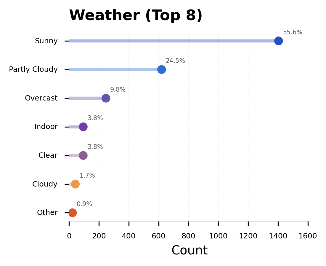
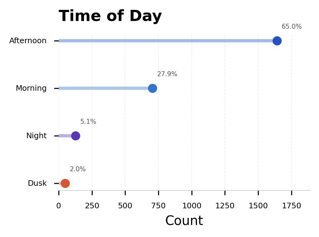
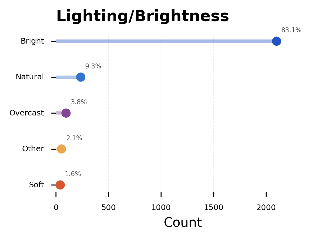
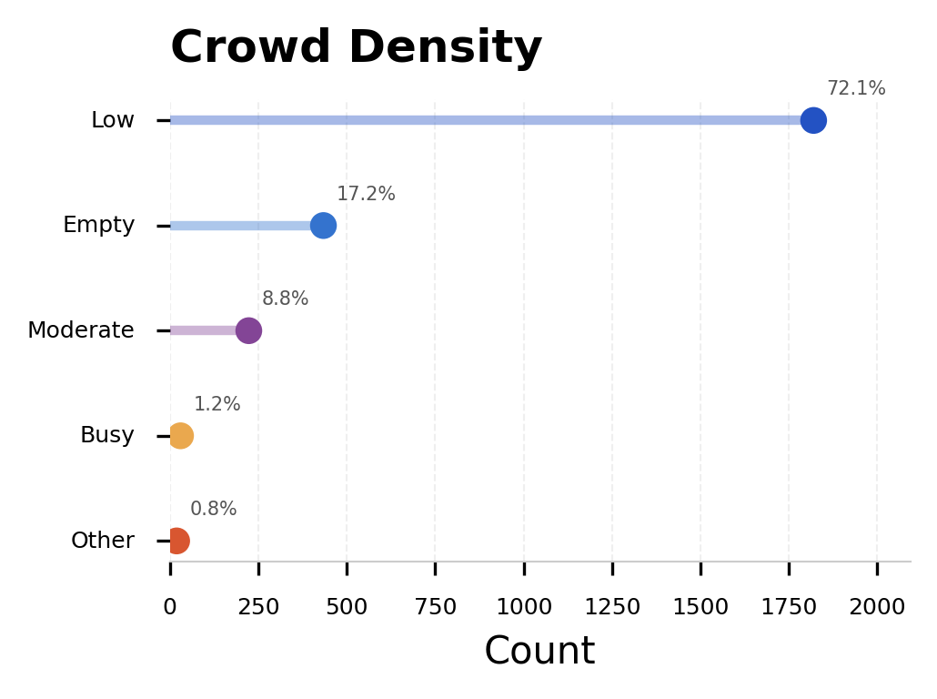
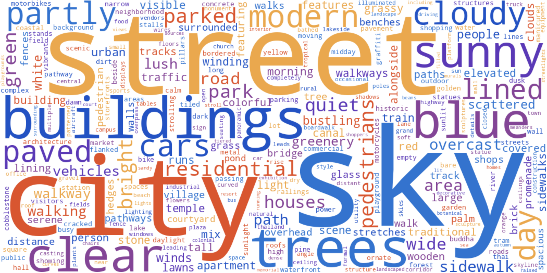
Scene categories, weather, lighting, time of day, crowd density, and natural-language captions for 2.5K scenes.
Privacy-Preserving
Censored 360° recordings with per-frame privacy masks for every fisheye and perspective view.
Pipeline
From 360° camera capture to metric 3D deliverables
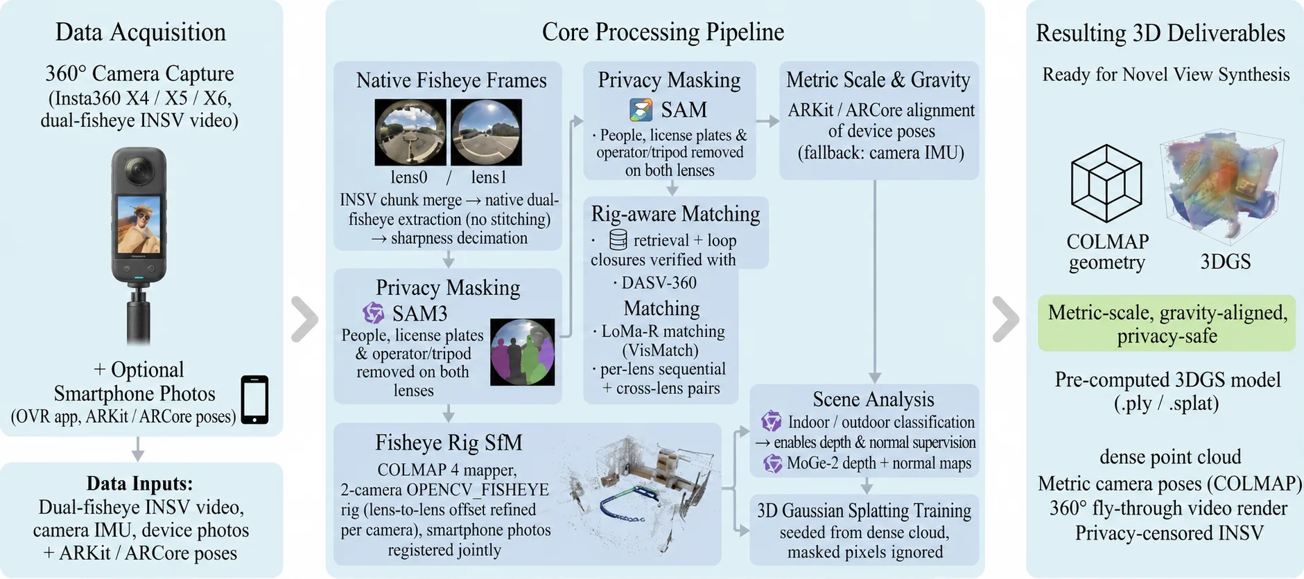
Metric scale is recovered from the camera's 1 kHz IMU and validated against an independent LiDAR reference: on nine 101–238 m surveys captured with a co-mounted 3DMakerPro Eagle scanner, the IMU-derived scale shows a 0.39% median absolute error (0.81% mean, 2.11% worst case). The full method and results are in our metric-scale research post, and the validation set is public on Hugging Face: Insta360 Surveys with LiDAR Reference for Metric-Scale Validation.
Statistics
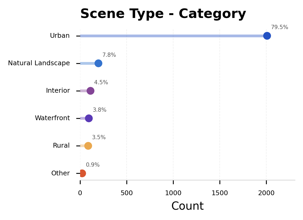
Dataset distribution and annotation insights
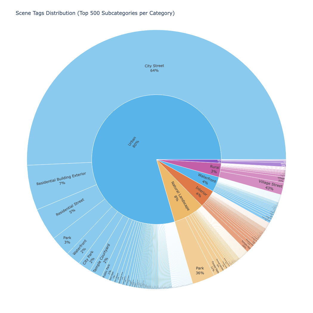
Scene Distribution
Environmental Conditions & Crowd Density
Captions
Download
A free research subset on Hugging Face, and the full dataset under commercial license
OverMaps-360Cam
2.7K scenes / 500+ hours of 8K dual-fisheye 360° video. Complete dataset with all modalities: raw .insv video, IMU and GPS, fisheye frames, perspective COLMAP, 3DGS, meshes, navmeshes, and annotations.
~60 TBRequest AccessCommercial license · licensing options
OverMaps-360_50
50 curated scenes with every modality, for quick experiments and benchmarking.
~1.1 TB🤗 DownloadCC BY-NC 4.0 · non-commercial research only · commercial use?
License & Access
Free for research, licensed for commercial use, or captured to your specification
OverMaps-360_50
Free for non-commercial research and benchmarking.
CC BY-NC 4.0- 50 curated scenes with every modality, hosted on Hugging Face
- Gated download: accept the terms and share your contact details
- Attribution required — please cite the dataset
- No commercial use, including training models for commercial products
Commercial license
The full OverMaps-360Cam dataset — or the part of it you need — for commercial R&D and products.
Full dataset · 2.7K scenes · ~60 TB- Train, fine-tune and evaluate commercial models
- Scoped to the scenes, regions and modalities you need
- The research subset is also available under commercial terms
- Delivered via cloud storage (e.g. an Amazon S3 bucket)
- Privacy-masked recordings (people, license plates), processed by an EU-based company
Custom data collection
Need places, environments or conditions that aren’t in the dataset? We capture them for you.
Smartphone · 360° camera- Specific cities, venues, indoor spaces or routes
- Captured through OVER’s global network of mappers
- Processed with the same pipeline: COLMAP poses, 3DGS, meshes, navmeshes and annotations
- Same privacy-preserving processing as the dataset
Not sure which option fits? Tell us about your use case or write to [email protected].
Citation
If you use OverMaps360-50 in your research, please cite our dataset
@misc{OverMaps360_50,
  author = {OverTheReality},
  title = {{OverMaps360-50 Dataset}},
  howpublished = {Hugging Face Datasets},
  url = {https://huggingface.co/datasets/OverTheReality/OverMaps360_50},
  year = {2026},
}